The short answer
The luxury market in Odessa is structurally invisible from the public road. Lake Keystone, Lake Calm, and the rest of the Keystone Lakes cluster sit behind long private drives and hedge lines, and the lakefront pricing band that defines the ZIP cannot be seen from a car. For listing photography inside 33556, that geography puts the drone reveal at the front of the package, not the end. This field note is about the invisible market and what the camera has to do.
We drove Gunn Highway north from the Van Dyke Road exit at 6:45 on a Wednesday in late October. The road runs through the Keystone village center and continues north into the rural Pasco band. The light came up flat behind the eastern pines. We counted private drives by the mile and could not see a single lake.
What we noticed
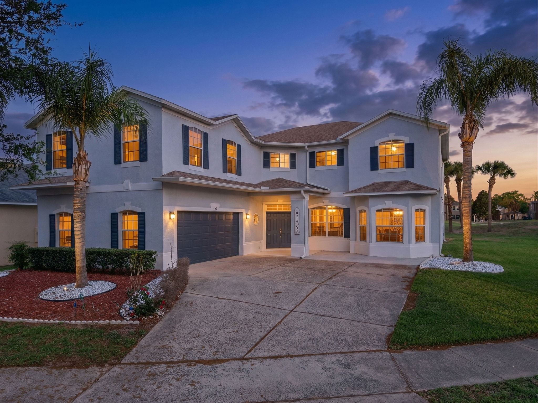
The first thing was the absence. Lake Keystone is 434 acres of spring-fed open water and it sits roughly half a mile west of Gunn Highway. From the public road you cannot see the lake. You cannot see the docks. You cannot see the shoreline. The hedge lines, the canopy, and the long private drives all do exactly the work they were meant to do. The most valuable acre of land in the 33556 ZIP is the acre you have to be invited to look at.
The second thing was the layered set-back. The luxury inventory does not sit at the property line. A typical custom estate on the lakefront band sits 200 to 400 feet behind the road frontage, behind a gate or a hedge line, at the end of a private drive that curves at least once before it reaches the structure. The same pattern repeats inside the Steeplechase equestrian community, where the lots run 2 to 5 acres and the homes sit set back behind paddocks and white split-rail fence. The drive-around never shows the product.
The third thing was the rural acreage band. Mobley Road and the secondary road grid carry the working acreage inventory at 1 to 10 acre lots. These parcels are not invisible the way the lakefront band is, but they are still not legible from the road. A 2-acre parcel with a 2,300 square foot ranch reads as a driveway and a hedge from a car. The outbuildings, the paddocks, the well house, and the pasture geometry all sit behind the structure. A buyer cannot map the lot from the road frontage.
The market read sits cleanly on top of the geography. The lakefront band on Lake Keystone carries pricing from roughly $800,000 at entry through $2 million to $2.5 million at the median per the Lake Keystone market profile. The Steeplechase tier runs north of $3 million on the small active inventory, with the recent 17301 Ballmont Park Drive listing on a 2.5 acre Steeplechase lot at $2,495,000 representing the standard tier. None of this pricing is communicable from the drive-around. The buyer pool either knows the area already or needs the drone reveal to map the land.
That figure is about 85 percent above the national median of $80,734. It is the structural reason the lakefront and Steeplechase tiers carry the pricing they do, and it is the reason the invisible-from-the-road geography matters. The buyer pool here is not driving by and stopping. They are coming in on the agent's prior research. The listing has to do the introduction the road cannot do.
The photographer's read
A working note on shooting 33556 in October. The drone pass is the introduction. For lakefront listings on Lake Keystone, Lake Calm, or Lake Cypress, the first frame of the reveal needs to be over open water at 100 to 150 feet with the dock, shoreline footprint, and open western horizon in the same frame. The same pass at 300 feet flattens the shoreline. The same pass from the road frontage misses the water entirely.
For the rural acreage band along Mobley Road and Gunn Highway, the 200 to 300-foot pass has to clear high enough to map the lot. Fence line, outbuildings, paddocks if equestrian, pasture or woods. The structure approach drops in the second half of the pass. A reveal that starts on the structure and pulls back communicates the opposite of what the buyer needs to know about a 2 to 5 acre parcel.
Drone clearance runs through LAANC across most of the southern 33556 corridor because the area sits inside the outer ring of Tampa International Class B airspace. The FAA UAS Facility Map cells in the southern part of the ZIP run 200 feet near the Veterans Expressway and step up to 400 feet on the northern Pasco portion. We verify the cell before scheduling and we notify Tampa International if the shoot sits within five miles of the airport.
Sunset behind the western pines runs around 6:50 p.m. in October. The lakefront band carries open western horizon with no canopy interference, which is the cleanest evening window on the inland Tampa Bay market. Get to the dock before 6:15 p.m. and the back-elevation twilight pass reads cleanly with the water in frame. The full read lives at /neighborhoods/odessa.