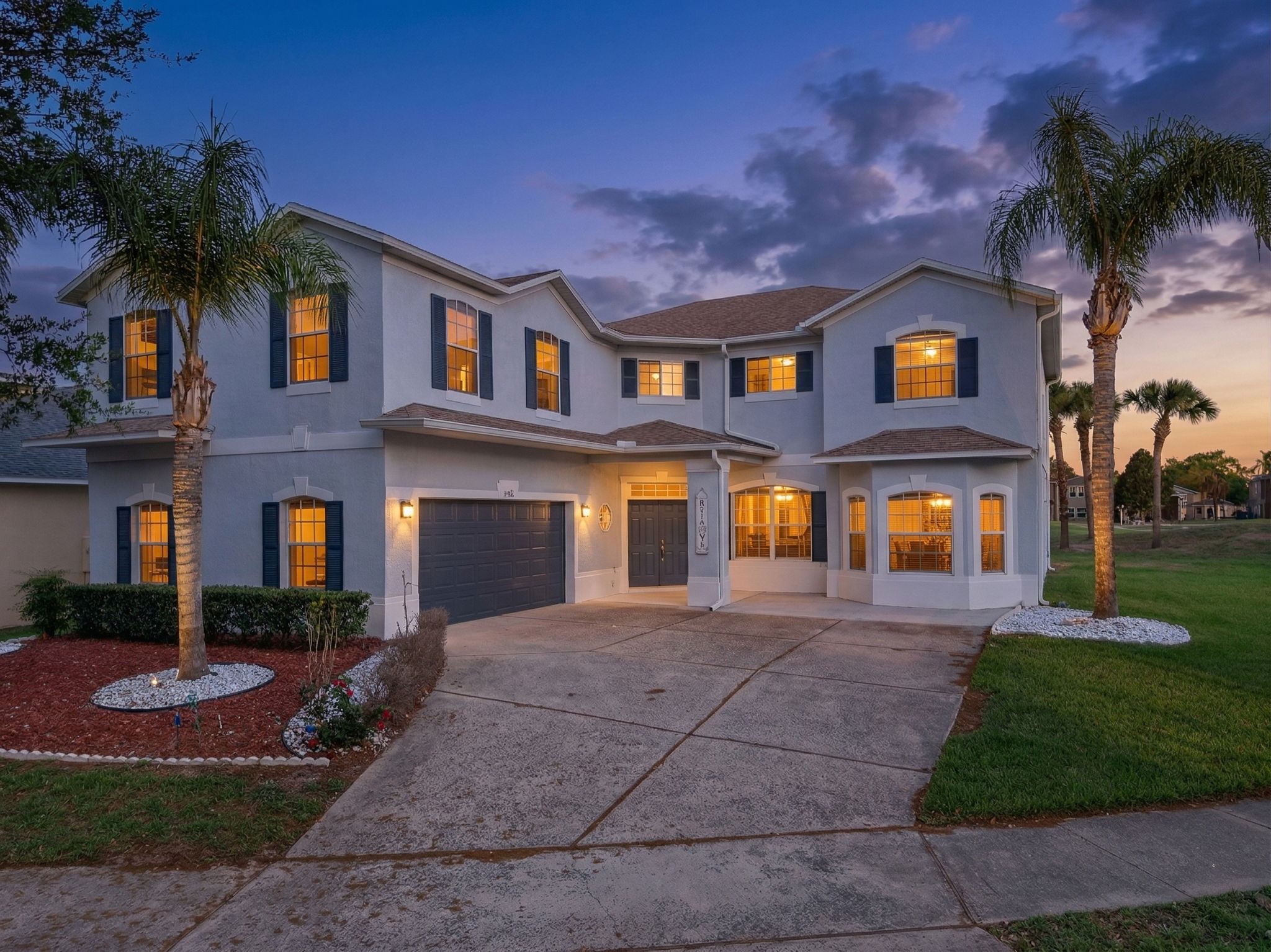
We were set up on the sand south of 27th Avenue at 6:38 on a Wednesday and the light came in flat across the Atlantic before the surfers reached the water. A pair of joggers passed behind the stilt house we were shooting. The rooftop deck on the third floor was the highest thing visible north or south for half a mile, and the sky over the dune line stayed open all the way to Ponce Inlet.
The short answer
New Smyrna Beach is the southern Volusia County coastal city split by the Indian River North into a mainland half (ZIP 32168) and a barrier-island half (ZIP 32169). The community chose a 35-foot residential height limit on the island in its land development code, and has held that line for more than fifty years. The city holds 31,538 residents and a median home value near $486,200. Flagler Avenue and Canal Street are the two retail spines.
What we noticed
The skyline is the part the photograph keeps doing the work for. Stand on the beach south of the drive-on access and look north toward the inlet, and the visible structures top out at three stories over parking. The barrier island holds a continuous low-rise residential pattern, and that pattern is what the city has consistently chosen. The land development code caps most island residential structures at 35 feet, which is why the beach reads as a residential corridor and not as a tourist corridor. The choice the community made in the 1970s is the choice the community has kept.
Five blocks west, Flagler Avenue runs from the river back toward the Atlantic in five blocks of independent surf shops, casual restaurants, and art galleries. No chains on the strip itself. The drive-on beach access at the foot of the street has been the city's signature visitor entry for seventy-plus years. The Riverview Hotel at the foot of the North Causeway bridge has held its corner since 1885. A woman walked her dog out of Third Wave Cafe with a paper cup and a folded newspaper. The Atlantic sat at the east end of the street, and the light from the rising sun lined up clean with the long axis of Flagler.
The oceanfront listing at 1024 South Atlantic Avenue at $1,395,000 is the example we use to explain the height limit to out-of-area buyers. Four bedrooms, three baths, 2,284 square feet on a 0.16-acre lot with a private dune walkover. The home was built in 1998 and tops out at three stories over a ground-level carport. That envelope is the standard expression of the 35-foot cap, and the price-per-square-foot at the upper end of the recent comp band is what direct beach frontage on the no-drive section is currently clearing. Land on the island is priced on its location rather than its absolute development capacity. Buyers here are paying for an unobstructed beach in front of the house and an unobstructed sky above it.
The number sits about 70 percent above the City of DeLand median 22 miles to the west. The premium is the barrier-island geography and the low-rise envelope reading together. Mainland Venetian Bay inventory in 32168 prices closer to the broader Volusia County mainland pattern. The split between the island band and the mainland band has rarely closed in any direction the city has been tracking.
The photographer's read
The Atlantic-facing exposure puts every oceanfront listing on a hard east front and a soft west back. Front-elevation pictures of oceanfront homes are a sunrise shot, period. We are on site by 6 a.m. in summer, 6:45 a.m. in winter. Indian River-facing properties on the island west side and the Venetian Bay mainland lots run the inverse. River-side sunset frames arrive at roughly 7:50 p.m. in late June and 6:10 p.m. in December. Flagler Avenue runs east to west, which lines it up cleanly with sunrise and sunset for a long-axis aerial.
The 35-foot residential height limit is a benefit for aerial framing. A drone pulled to 100 feet above ground level frames the home, the dune line, and the Atlantic in one frame with room to spare. The same shot in a high-rise corridor would require a sky-side angle and lose the beach context entirely. The New Smyrna Beach Municipal Airport (KEVB) sits on the mainland west of US-1 and controls a Class G ring east to roughly the river. Most barrier-island residential drone work is clear of the ring, but we file LAANC for anything west of South Atlantic Avenue. The city prohibits drone launches and landings from any city park or beach access without a permit, which we secure ahead of every shoot.
We packed the gear into the truck on Esther Street as the first surfboards crossed the dune at 28th. A pelican line worked the swell line south of the no-drive marker. The boardwalk over the salt marsh at Smyrna Dunes Park had a sunrise walking group already three planks in. The full read lives at /neighborhoods/new-smyrna-beach.