The short answer
Groveland sits on the central Florida sand ridge, which is the rare local geography that produces actual rolling ground rather than the flat slab that defines most of the state. For listing photography inside ZIP 34736, that elevation changes how horizon lines, drone reveals, and front-elevation light read against the rural acreage corridor. This field note is about the ridge and what it does to the picture.
We drove County Road 565A west of the city at 6:55 on a Wednesday in late October, headed toward an acreage parcel near Lake Erie Road. The road climbed, dropped, and climbed again inside the first two miles. There is no other county road in our coverage map where the headlights tilt up and down that often before sunrise.
What we noticed
The first thing was the ridge itself. The central Florida sand ridge runs the spine of the peninsula and gives Lake County the only sustained elevation in the region. The Florida Citrus Tower sits on the same ridge fifteen minutes northeast in Clermont, and it has been the navigational landmark on US Highway 27 since 1956. From a drone at 200 feet above County Road 565A you can read the ridge contour as a clean rolling line, not the flat horizontal that defines almost every other rural shoot in our coverage. That contour is the photographic identity of the western 34736 corridor.
The second thing was the Cherry Lake Tree Farm frontage on the north side of the city. 1,300 acres of field-grown shade trees and ornamentals in production, in rows that follow the rolling ground. The road frontage along Cherry Lake Road carries the most visually distinctive scenery in the northern half of the ZIP. The farm is wholesale only, but for a driver passing through the corridor at sunrise the rows of nursery stock against the ridge contour read as something closer to a working agricultural landscape than the master-planned belt that defines most of south Lake County.
The third thing was the acreage band. Parcels of 1 to 10 acres each along County Road 565A and Lake Erie Road. Some equestrian small-farm tracts with stable buildings and arena footings. Others working pasture or hay production on the rolling ground. The road grid is loose. The addresses sit well off the road. The ridge means a 5-acre parcel here is not a flat 5 acres. It is 5 acres with elevation change, which photographs entirely differently from the flat pasture parcels east of I-4.
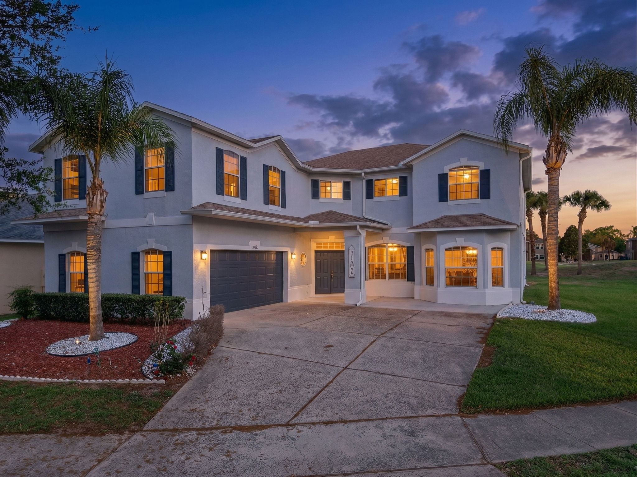
The acreage band is the price band that uses the ridge. A recent active listing on Spirit Lake Road at $749,000 sits on 2.5 acres with outbuildings, well and septic, and paved access off County Road 565A. The same 2.5 acres on flat ground east of I-4 would not read the same in a drone pass. The value here is partly the price-per-buildable-acre advantage, which runs roughly $250,000 to $400,000 per acre depending on access, and partly the topography that the drone reveals in the first five seconds of the pass. For listings on the master-planned side of the city, the ridge matters less because the subdivisions sit at uniform pad-graded elevations, but the rural product cannot be communicated from the ground.
That figure is well above the national average and is the structural reason inventory turns slower here than in the Orange County trade zone. Owners stay. The buyer pool splits cleanly into three groups: young families in the post-2018 Garden Hills and Waterside Pointe belt, retirees inside Trilogy Orlando along US Highway 27, and rural buyers along the unincorporated band. Most of the working-age slice commutes east on State Road 50 or via the Florida Turnpike Minneola interchange at exit 279, with downtown Orlando running 35 to 45 minutes in normal traffic.
The photographer's read
A working note on shooting 34736 in October. The ridge is the planning constraint. For acreage parcels on County Road 565A and Lake Erie Road, the drone pass at 200 to 300 feet has to clear high enough to read the contour. A pass at 100 feet flattens the topography back into the same horizontal that defines flat-ground listings. The first frame of the reveal needs to show the rolling line. After that we can drop the elevation for the structure approach.
For Trilogy Orlando along US Highway 27, the tile roofs cast hard cross-shadows after 3 p.m. in winter, similar to Kings Ridge in adjacent Clermont. Move the twilight pass before 6:15 p.m. The Magnolia House clubhouse photographs cleanest at 100 feet during golden hour when the resort pool decking reads strongest, and Trilogy is a Shea Homes-built community where the buyer pool reads the amenity images before the floor plan.
Drone clearance is straightforward. Most of Groveland sits in Class G airspace with standard 400-foot ceilings, with the exception of the eastern edge near State Road 50 where Class E surface overlays kick in. We verify the FAA UAS Facility Map cell before scheduling along the Clermont border. Inside Trilogy the ambient traffic is heavier, but the airspace itself is cleaner than the Mount Dora western edge.
Sunset behind the ridge runs around 6:45 p.m. in October. The Citrus Tower silhouette is occasionally available as a horizon-line element for east-facing properties, which is the rare element of central Florida architecture in this market. The rolling ground does the rest. The full read lives at /neighborhoods/groveland.